

A hurricane needs a very specific set of conditions that Poland will never be able to supply, however intense local storms become. This is not a matter of geographic luck. It is a set of hard physical requirements that an inland sea and a landmass simply cannot meet.
Why ocean temperature is the requirement you cannot work around
A hurricane, like any tropical cyclone, needs water at least 26.5 C (80 F) down to a depth of at least fifty metres (about 165 feet) to supply enough heat energy to sustain the system. That energy comes from evaporating warm ocean water, which feeds the whole mechanism. Poland has no ocean coast, and the Baltic, the only sea within reach, never comes close to that threshold even in the warmest summers.
A tropical cyclone requires sea temperatures of at least 26.5 C (80 F) down to about fifty metres (165 feet). The Baltic never approaches that threshold.
How a Polish storm differs from a tropical cyclone
The storms that cross Poland in summer are convective storms, driven by heat from the warmed ground and moisture rising off the land, not by ocean heat. Their structure is entirely different: single storm cells or squall lines lasting hours, rather than systems rotating around an eye and lasting days or weeks the way a hurricane does.
Even when the remains of a former hurricane occasionally reach Europe, weakening and transforming into an extratropical cyclone on the way, they arrive mainly as heavy rain and strong wind, without the eye and eyewall structure that defines a real hurricane.
What happens when hurricane remnants really do reach Europe
Systems that began as Atlantic hurricanes do sometimes arrive in weakened form over western or central Europe. Before that happens, though, the system goes through a transformation called extratropical transition: it loses its tropical structure, including the characteristic eye and eyewall, and starts behaving like an ordinary mid-latitude low, drawing energy from the temperature contrast between air masses rather than from ocean heat.
Such a system can still bring very strong wind and heavy rain, sometimes comparable to local storms, but calling it a hurricane at that point would be misleading. It is a different kind of weather system, governed by different physics, even though its origins trace back to a tropical cyclone a few days earlier.
What Polish storms do share with hurricanes
Although the formation mechanism is entirely different, both phenomena share one element: strong updrafts lifting warm, humid air. In a hurricane that process happens on an enormous scale, driven by the ocean. In a Polish convective storm it happens on a much smaller scale, driven by heated ground. The physical principle, warm air rising to build a storm cloud, is identical; only the scale and the energy source differ completely.
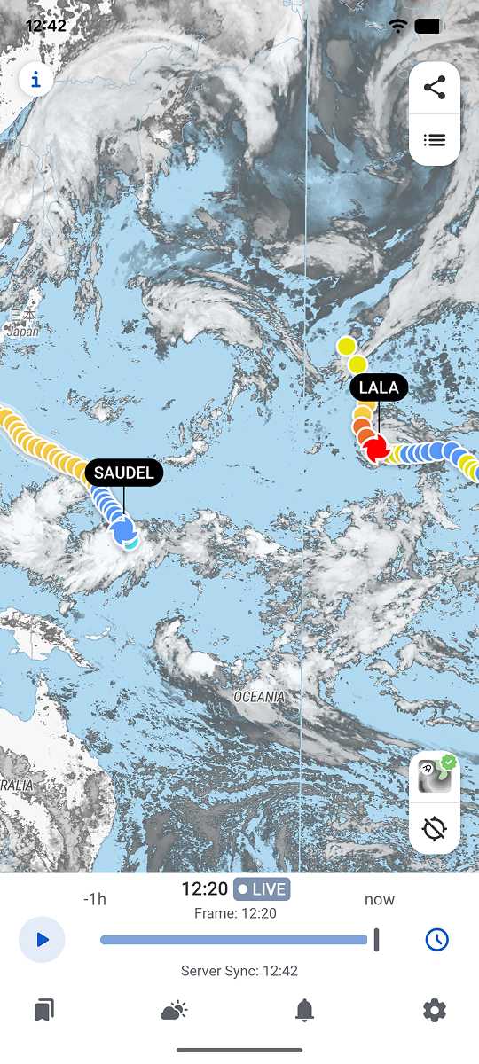
RainViewer shows live radar for any location worldwide, so you can compare the structure of a Polish convective storm directly against a tropical system elsewhere.
Compare the structures, not just the names
Understanding why Poland will never see a real hurricane also helps clarify what a Polish storm actually is: a smaller, land-based relative of the same basic physical mechanism, operating at a completely different scale.
RainViewer shows live radar for any location worldwide, making it possible to compare the structure of a local storm against tropical systems observed elsewhere.



 RainViewer
