

A day at 35 C (95 F) is not automatically a heat wave. For Météo-France, a canicule has a precise definition, built on maximum and minimum temperature thresholds that have to be exceeded for several consecutive days, and those thresholds change from one department to the next.
Why there is no single threshold for the whole country
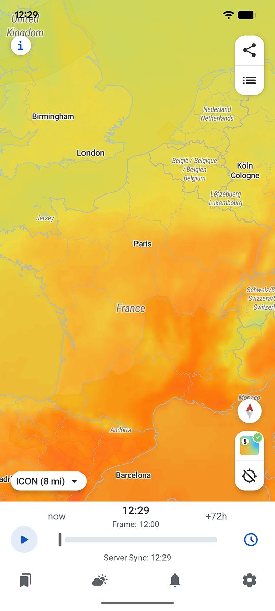
Météo-France defines a canicule using two temperature indicators per day, a daytime maximum threshold and a night-time minimum threshold, both calculated from decades of local climate records. A department used to very hot summers, in the south, carries a higher threshold than one where those temperatures are rare, such as Brittany in the northwest.
Météo-France calculates its heat-wave thresholds department by department from local climate records, which means the same temperature can trigger an alert in one region and not in another.
That relative approach explains why a hot spell in Brittany, at temperatures that would look entirely normal in Provence, can still be classified as a canicule. What counts is not the absolute temperature but the gap from what the region usually experiences.
Why the night matters as much as the day
The part of the definition most people miss is the role of night-time temperatures. A night that does not cool down enough stops the body from recovering from the heat it absorbed the day before, which sharply increases the health impact of a heat episode, especially for older or vulnerable people. That is why Météo-France always builds a night-time minimum threshold into the definition, rather than looking only at the daytime peak.
Why urban areas cross the threshold first
Large cities often reach the heat-wave thresholds sooner than the countryside around them, because of the urban heat island: concrete and asphalt store heat through the day and release it slowly through the night, keeping night-time temperatures from falling far enough. It is exactly that night-time criterion, built into the Météo-France definition, that lets a city centre officially enter a canicule several days before a neighbouring rural commune sitting in the same mass of hot air.
That difference also explains why health authorities focus first on large urban areas during a heat alert, since that is where the threshold is reached first and where the missing night-time recovery weighs most heavily on vulnerable people.
What the word canicule does not tell you on its own
Hearing that France is in a canicule says nothing about the exact situation in one specific commune, or about how long the episode is likely to last. A heat wave varies a great deal from region to region depending on local thresholds, and its duration depends directly on how stable the high-pressure system behind it is, which means following a multi-day forecast rather than trusting the word canicule in a headline.
RainViewer shows the current temperature alongside a multi-day forecast, so you can see when a heat-wave episode is actually likely to end for one specific place.
Follow the actual forecast, not just the word
The term canicule covers very different realities depending on the region and on how long the episode lasts. Knowing that one is under way is a useful first marker, but anticipating its end means following how the temperature actually evolves over several days for one specific place.
RainViewer combines the current temperature with a multi-day forecast, so you can see in advance when the change that ends a heat wave is genuinely likely to arrive.

 RainViewer
