

A yellow alert is often read as “nothing to worry about”, simply because it is the first colour on the scale and not the most feared one. In reality, the Protezione Civile’s official definition is more specific than that, and ignoring it entirely can mean underestimating situations that carry real risk without being extreme.
The exact definition, not just “the lowest level”
A yellow weather alert is a warning of ordinary criticality, issued for weather that is localised and intense, or widespread and not particularly intense but persistent over time. In practice, yellow covers two very different situations: an intense event confined to a small area, or a broader, milder event that lasts longer. Both get the same colour, for different reasons.
Italy’s yellow alert covers both intense but localised weather and widespread, less intense but persistent weather: two different situations that receive the same colour.
Under a yellow code, the forecast allows for isolated erosion, shallow landslides, or locally dangerous rainfall, enough to advise against some outdoor activity without requiring local authorities to activate emergency measures.
Why green does not mean zero risk
It is worth noting what happens at the opposite end of the scale. Green indicates the absence of significant forecast phenomena, but it does not entirely rule out isolated local events. Even the lowest colour on the scale is not an absolute guarantee; it simply signals that the forecast risk is statistically minimal.
Why the same event can carry different colours on the same day
A little-known detail of the Italian system is that the same zone can receive different colours for different risks on the same day: yellow for severe thunderstorms and, at the same time, green for wind risk, if the forecast wind does not reach the threshold for a higher level. Each type of phenomenon, rain, wind, thunderstorms, heat waves, is assessed separately, even when all of them come from the same atmospheric system.
That separation by risk type explains why a bulletin can look contradictory at first glance, with several different colours for the same area on the same day. It is not an inconsistency in the system, but a reflection of the fact that a single weather event can produce risks of very different intensity for each type of phenomenon considered on its own.
What really changes from yellow to orange
The most important practical difference between yellow and orange is not only intensity, it is the institutional response. Under yellow, local services remain in a state of simple watch. Under orange, the Regional Alert State begins, with municipalities and prefectures acting on their civil protection plans. That jump in organisational response often matters more, to people living in the affected area, than the change of colour itself.
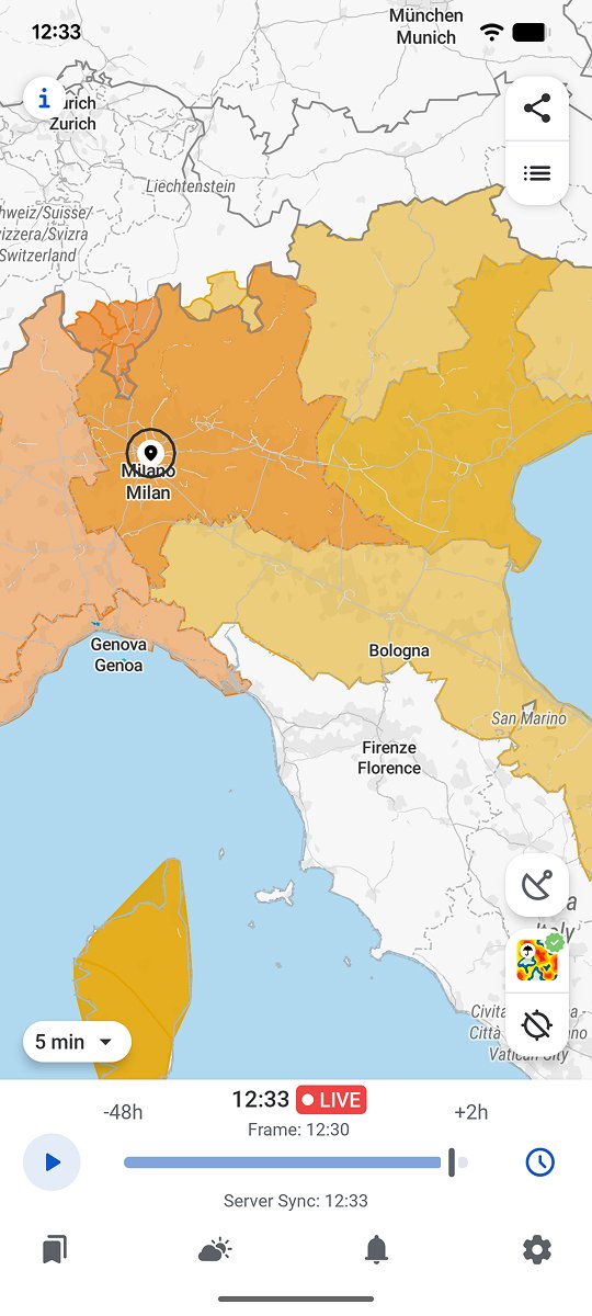
RainViewer shows official weather alerts with their exact colour directly on the radar map, relative to a saved location.
Read the colour together with the text, not on its own
The colour of an alert is a useful visual summary, but the full bulletin always contains a written description of what is actually expected. A yellow alert for snow in an area unused to snow can cause more real disruption than an orange alert for wind in a region well equipped to handle it.
RainViewer shows official weather alerts with their exact colour directly on the radar map, so you can see immediately which alert level actually covers a saved location.



 RainViewer
