

On 29 October 2024, Turis, in the province of Valencia, recorded 771.8 l/m2 (30.4 inches) in 24 hours, and 621 l/m2 (24.4 inches) of that fell in the afternoon alone. Chiva took around 600 l/m2 (23.6 inches), almost all of it from 15:00 onwards. The episode caused 233 deaths in Spain, 225 of them in the province of Valencia.
What a gota fria is and why AEMET says DANA
DANA stands for depresion aislada en niveles altos, an isolated depression at high levels. It is a pocket of cold air that separates from the jet stream and sits several kilometres up, cut off from the main flow. Gota fria is the popular name for the same phenomenon.
A DANA does not produce rain on its own. It creates instability when the cold air above meets warm, humid air near the ground. The greater the temperature difference between the two levels, the easier it is for the warm air to rise and form storms.
Why autumn is the season of risk
In September and October, the Mediterranean still holds the heat it accumulated through the summer, and cold air aloft starts arriving with the first systems of the year. That combination supplies heat and moisture below and cold air above.
In 2024, the DANA formed a mesoscale convective system, a group of storms that keep re-forming over the same area. An ordinary storm passes in an hour. A system that regenerates stops moving, and the same place takes rain for hours.
The rain that does the damage is measured in hours
Chiva took around 600 l/m2 (23.6 inches), almost all of it from 15:00 onwards. In Turis, 621 l/m2 (24.4 inches) fell in a single afternoon, within a day total of 771.8 l/m2 (30.4 inches). Real (569), Bunol (539) and Macastre (533) also passed 500 l/m2 (19.7 inches). One litre per square metre equals one millimetre of water depth.
It is considered the second most serious hydrological disaster in modern Spanish history, after the Valles floods of 1962.
A DANA turns into a flood when the rain concentrates over the same area for hours.
Not every DANA produces flooding. The damage depends on where it sits, how much moisture it draws from the sea, and how many hours it stays over the same area.
What to watch when a DANA is over your area
Three things are worth watching: official AEMET warnings, radar, and accumulated rainfall.
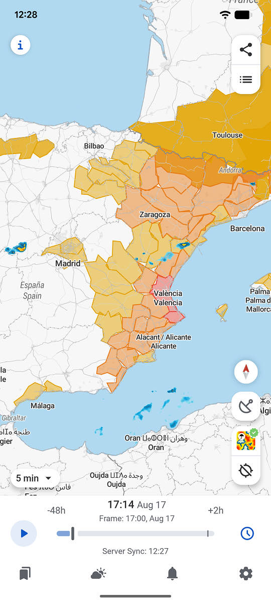
The Radar + Satellite layer shows precipitation and cloud structure in the same view, so both the DANA and the storms it generates are visible.
Animated radar shows whether the storms are passing through or repeating over the same point. Accumulated rainfall shows how much has already fallen, something live radar does not give on its own.
RainViewer shows the accumulated rainfall at any point on the map over the time window you choose, from 1 to 48 hours back.
Accumulated rainfall does not indicate the level of a river or a ravine. Official warnings from the national weather services remain the reference for deciding when to act.
Watch the rain before it becomes urgent
In a DANA, the difference between an afternoon of storms and a flood lies in how many hours the rain repeats over the same place. RainViewer refreshes radar every 5 minutes, so it is visible whether the system is moving on or staying put.


 RainViewer
