

The Hat Yai flash flood of November 2025 started from one number: 335 millimetres (13.2 inches) of rain in a single day, on 21 November. Across the three days from 19 to 21 November, the total reached 630 millimetres (24.8 inches), according to the Department of Disaster Prevention and Mitigation. That is more than the city’s canal system can take.
What a flash flood is
A flash flood is flooding that develops quickly, with less than 6 hours between the rain falling and the water rising. That sets it apart from standing floodwater that accumulates over days. In Thai, water that runs down off the hills at speed is usually called nam pa lai lak.
A flash flood needs three things to come together. The first is heavy rain in a short window. The second is ground that is steep or already saturated, so the water cannot soak in fast enough. The third is a short watercourse taking runoff from an area wider than it can drain. Take any one of them away and heavy rain only wets the roads. Put all three together and the water level rises very fast.
A flash flood means flooding with less than 6 hours between the rain falling and the water starting to rise.
Why the south sees flash floods so often
Southern Thailand has two coasts whose rain does not arrive at the same time. The Andaman side has its maximum in September, while the Gulf of Thailand side peaks from November to January, with the northeast monsoon. Most of the south averages 1,200 to 1,600 millimetres (47 to 63 inches) of rain a year, but the windward mountains get far more than that. Ranong province exceeds 4,500 millimetres (177 inches) a year.
The result is that the heavy rain of the Gulf side falls on ground that is already wet. Less water soaks in and more runs into the canals. The more days the rain repeats, the less spare capacity the drainage has left.
Cities add one more factor. Roads, buildings and concrete surfaces stop water soaking into the ground, so almost all of the rain that falls goes into the drains and the canals. The more a city expands, the more water reaches the canals in the same amount of time.
Hat Yai 2025: the water came in three waves
According to The Nation, the water entered Hat Yai in three waves. The first, in the morning, came from the smaller canals on the eastern side. The second, in the afternoon, came off the high ground. The third, in the evening, was a huge volume out of Khlong U-Taphao. The city’s canal system had to take water from three sub-basins at once and was overwhelmed. In some areas the water reached 2 metres (6.6 feet).
The lesson is that the time the rain falls and the time the water arrives are not the same time. Rain falling on high ground or upstream takes time to run down, and each sub-basin delivers its water to the city at a different hour. A sky over the city that is starting to clear does not mean the water has stopped rising.
Reading the signs before the water arrives
Look at accumulated rainfall, not only at how hard it is raining right now. The 630 millimetres (24.8 inches) over three days came from rain that kept going. The accumulated total says how much the soil and the canals have already taken.
Look at where the rain is falling upstream. Rain on the hills around the city reaches the city within a few hours, even while the sky above your house is still bright.
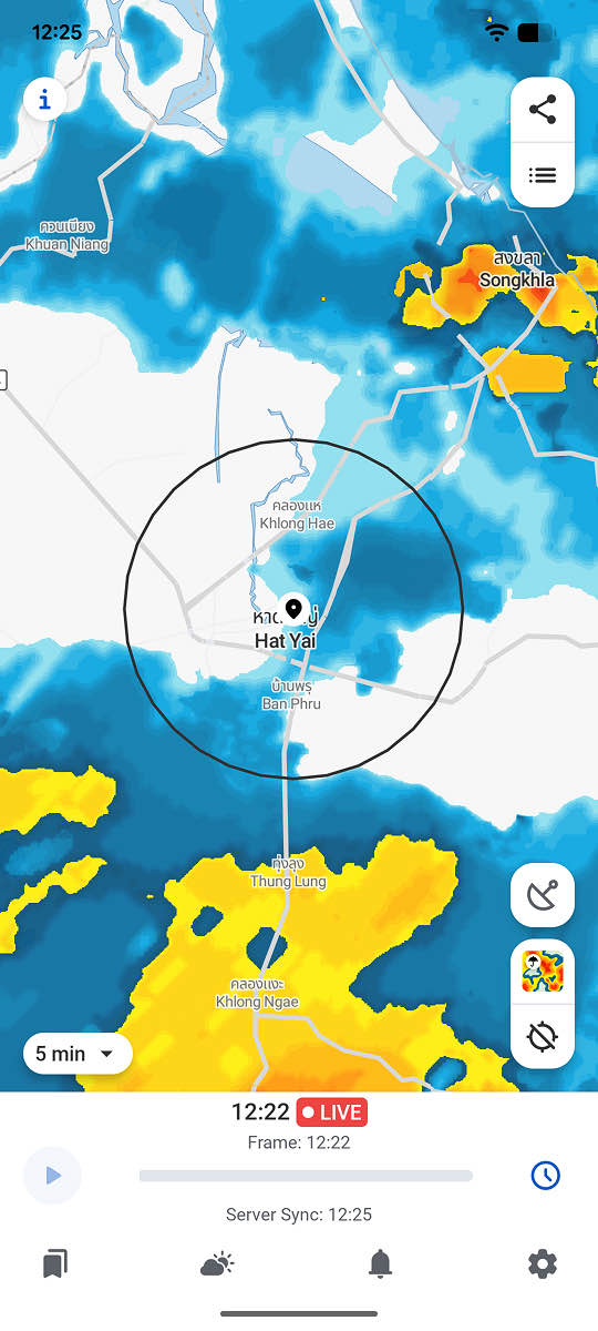
Look at how the rain cells are moving. Animated radar shows whether a band of rain is passing through or circling back over the same area. The repeating pattern is the one that builds up totals fastest.
RainViewer shows the accumulated rainfall at any location on the map over a window you choose, from 1 to 48 hours back, with the rainfall figure and the intensity level at the point you tap.
Accumulated rainfall says how much rain has already fallen. It does not say what the water level in a canal is. Announcements from the official agencies remain the primary information for an evacuation decision.
Decide from the actual rainfall data
A flash flood leaves no time to go looking for information once the water is at the door. What can be done is to watch accumulated rainfall and the position of the rain cells hours in advance. RainViewer refreshes its radar data every 5 minutes, so it is visible whether a band of rain is closing in or passing by.



 RainViewer
