
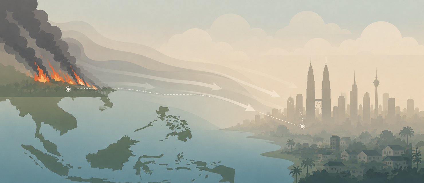
Sarawak can record “very unhealthy” air readings without a single major fire inside the state. That is not a strange outcome in the context of Southeast Asian regional haze. It is how the system actually works, and understanding the mechanism explains why not being the source does not mean being safe.
How smoke travels hundreds of kilometres
Smoke from large fires does not stay near the ground close to its source. It rises into the mid-atmosphere, where winds tend to be steadier and more persistent than at the surface. At that level, monsoon winds can carry it hundreds of kilometres before it descends again to a level where people and air quality instruments can detect it.
Smoke from large fires rises into the more stable mid-atmosphere, which lets monsoon winds carry it hundreds of kilometres before it settles back to the surface far from the original source.
That is why western Sarawak, which borders West Kalimantan directly, is often among the first areas in Malaysia to be affected when fires increase on the Indonesian side, even with no hotspots detected inside the state’s own borders at the time.
Why regional agreements cannot stop it completely
The ASEAN Agreement on Transboundary Haze Pollution, signed in 2002 and ratified by all ten member states by 2014, was the world’s first regional framework binding a group of neighbouring countries to address transboundary haze. In 2024, ASEAN launched a haze coordination centre and adopted the Second Haze-Free Roadmap covering 2023 to 2030.
But a regional agreement cannot remove the underlying cause: burning as the cheapest way to clear land. As long as the economic incentive to burn stays lower in cost than the alternatives, the annual cycle tends to repeat, even as the regional cooperation framework keeps being strengthened.
Why Sarawak is so often affected first
Geography plays a large role in deciding which area is affected first. West Sarawak, bordering West Kalimantan directly, is often among the first parts of Malaysia to record unhealthy air when fires increase across the Indonesian border. That is not because Sarawak has more local pollution sources, but because it sits closest to the main source of smoke and because monsoon winds blow consistently in that direction during the dry season.
Peninsular Malaysia, meanwhile, is more affected by smoke from Sumatra, following a different wind direction but the same mechanism: transport across the Strait of Malacca in a stable atmospheric layer, with no local fire needed to push API readings up.
What the eye cannot tell you
The difference between local haze and transboundary haze cannot be judged by looking at the sky. Both look the same, hazy and smoky. What separates them is data: where the wind is coming from, and where the hotspots actually are at that moment, information that only regional monitoring can provide, not local observation.
RainViewer shows regional smoke data alongside rain radar, so you can see how the wind carries haze from distant fires toward a specific location in Malaysia.
Watch the real source, not just the local sky
Understanding that Malaysia’s haze often originates in another country does not mean nothing can be done locally, but it does explain why local measures alone cannot solve the problem. Effective monitoring needs regional data, not just a look at the sky overhead.
RainViewer shows regional smoke data alongside rain radar, so you can see how the wind is carrying haze from distant fires toward a specific location.



 RainViewer
