

Hurricane season in Mexico opens on 15 May in the Pacific and on 1 June in the Atlantic, and closes on 30 November in both, according to Conagua, the national water commission. Conagua notes that it does not rule out systems forming outside those dates.
Two seasons, one closing date
Mexico takes cyclones from two oceans. The Pacific basin opens first, on 15 May. The Atlantic basin, which includes the Gulf of Mexico and the Caribbean Sea, opens on 1 June. Both close on 30 November.
That two-week difference means a storm in the Pacific can form before the Atlantic season officially exists. It is worth following both basins, not only the one nearest your coast.
What was forecast for 2026
The Servicio Meteorologico Nacional published its forecast on 22 April 2026: 18 to 21 named storms in the Pacific, 9 to 11 hurricanes and 4 to 5 major hurricanes. NOAA, on 21 May, forecast 15 to 22 named storms, 9 to 14 hurricanes and 5 to 9 major hurricanes for the Pacific, and cited the expected development of El Nino.
That same El Nino reduces activity in the Atlantic. NOAA forecast 8 to 14 named storms there. For how those numbers are built, read how the 2026 hurricane forecasts are made .
A season forecast counts how many storms are expected across six months. It does not say where any of them will form or where any of them will make landfall.
A hurricane can change in hours
Hurricane Otis shows why a season count is no basis for a decision. On 22 October 2023, the first National Hurricane Center forecast called for a peak of 72 km/h (45 mph), that of a weak tropical storm, and a system that would stay offshore. Otis made landfall west of Acapulco on 25 October as a Category 5 hurricane, with winds of 260 km/h (160 mph). Its maximum winds rose by 169 km/h (105 mph) in 21 hours.
When a system intensifies like that, the margin for preparing a house, a route or a trip is measured in hours. That is why a storm is followed with current data and not with the season average.
How to follow a storm forming nearby
Four checks serve through the whole season:
- Where the centre of the system is and which way it is moving.
- What radar shows on the coastlines where it is already raining.
- What the rainfall forecast shows for the next 72 hours.
- Which official warnings are active for your area.
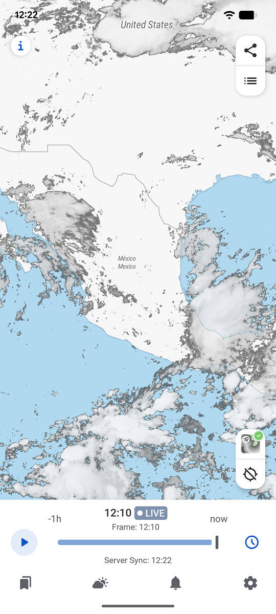
RainViewer brings radar, the satellite layer and Forecast 72h onto one map. Radar refreshes every 5 minutes.
RainViewer alerts users when a tropical storm forms nearby, timed to when the storm is expected to reach their saved location.
Before the rain arrives
The season dates are useful for planning. This week’s decision depends on the system that exists this week, and on what the official warnings from the Servicio Meteorologico Nacional and current local data show.



 RainViewer
