Available Pro Radar Products
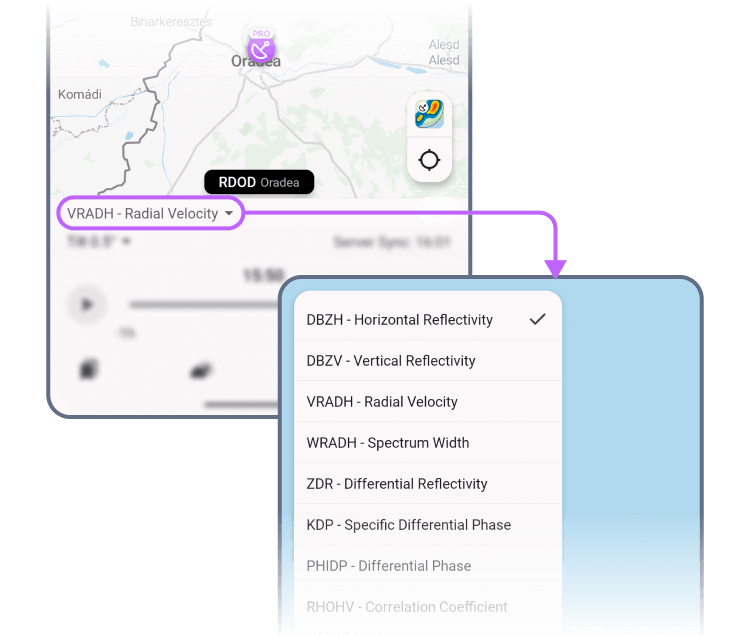
The following radar products are available in RainViewer:
DBZH - Reflectivity
Standard reflectivity scan. Tracks horizontal precipitation intensity. >50 dBZ suggests hail or severe storms.
DBZV - Vertical Reflectivity
Measures vertical radar returns. Useful for storm structure analysis.
VRADH - Velocity
Shows how fast precipitation particles are moving relative to the radar.
RHOHV - Correlation Coefficient
Identifies uniform vs. mixed targets. Low values may indicate debris or hail.
ZDR - Differential Reflectivity
Difference between the horizontal and vertical reflectivity.
KDP - Specific Differential Phase
Detects intensity of precipitation.
PHIDP - Differential Phase
Raw phase data your radar collects before it calculates KDP.
SNR - Signal-to-Noise Ratio
Radar clarity check. Higher values mean cleaner data.
HCLASS - Hydrometeor Classification
Advanced ID of rain, hail, snow, graupel, or non-weather objects.
WRADH - Spectrum Width
Shows wind turbulence. High values? Think shear or gust fronts.
PMI - Polarimetric Meteo Index
Combines multiple radar variables to flag storm features.
SQIH - Signal Quality Index
Summarizes radar return reliability. High SQI = clean, trustworthy echo, low SQI = noisy or suspect return.
Total Velocity
Sum of all detected motion. Helps analyze overall wind dynamics.
Total Hail Index
Scores hail likelihood. High = damaging hail potential.
LOG - Logarithmic Reflectivity
Alternative reflectivity scale to highlight fine gradients.
CCORH, CCORV - Corrected Correlation
Corrected correlation for horizontal and vertical scans. Helps refine clutter filtering.
CPAH, CPAV - Horizontal & Vertical CPA
Confidence index for horizontal and vertical polarimetry. High = reliable returns.
VRADV - Vertical Velocity
Tracks vertical wind toward/away from radar. Useful for storm structure.
WRADV - Vertical Spectrum Width
Measures wind turbulence in the vertical plane. Can flag strong updrafts.
CSP - Doppler-Channel Clutter Signal
Measures the strength of stationary or slow-moving radar returns.
TH, TV - Horizontal & Vertical Linear Total Power
Tracks raw signal strength in the horizontal and vertical channels. Used for calibration and quality control.
 RainViewer
