Hurricane Tracking Map
Tropical storms are areas of extremely low pressure on the earth’s surface. A tropical storm with a wind speed greater than 73 mph belongs to the category of hurricanes. Strong hurricanes of category 2 and higher can cause natural disasters and damage. Therefore, it is crucial to recognize them beforehand and keep the situation under control. A live map of these natural phenomena would help to detect hurricane evacuation zones, warn about a disaster such as flooding, and contribute to public safety.
Active Hurricanes
Last updated:
| Name | Category | wind speed | moving |
|---|---|---|---|
 FAUSTO
 | Category 2 Hurricane | 130 kmh | W 23 kmh |
 GENEVIEVE
 | Category 5 Hurricane | 250 kmh | NW 21 kmh |
|
NOUL | Typhoon | 120 kmh | NW 17 kmh |
|
DOLPHIN | Super Typhoon | 65 kmh | W 29 kmh |
Our hurricane radar page allows you to track the movement of hurricanes and tropical storms on the map. To find out where the actual storm is currently moving, click the icon in the upper-right corner of the map. You will see chains of colorful dots forming the past, current, and predicted path of a hurricane, cyclone, or tropical storm. The movement area forecast predicts a zone where a cyclone can go with the most probable path in the center of the zone.
Different types of tropical storms are marked with different colors on the map:
- Tropical Depression (<38 mph)
- Tropical Storm (39-73 mph)
- Category 1 Hurricane (74-95 mph)
- Category 2 Hurricane (96-110 mph)
- Category 3 Hurricane (111-129 mph)
- Category 4 Hurricane (130-156 mph)
- Category 5 Hurricane (157 mph or higher)
More in app
In the RainViewer app, you can dive deeper into upcoming tropical storms, from early formation to landfall and beyond.
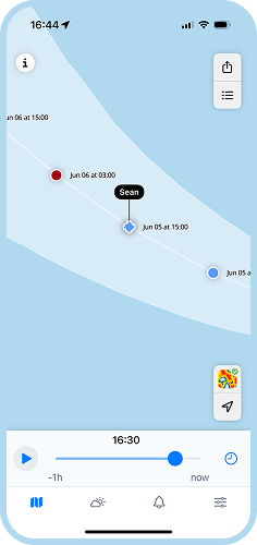
Storm Timeline
Track the storm’s full journey. Tap any point on the path to see real-time wind speed, category, and direction. See where it started, how fast it's moving, and where it’s likely to hit next.
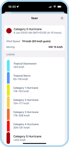
Storm Details
Category 1 or Category 5, you’ll know exactly what you’re dealing with. Decode intensity with one glance and decide if it’s time to head to the cellar or just secure the patio furniture.
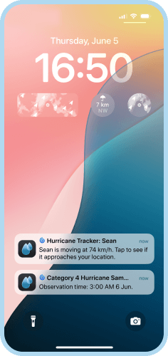
Push Notifications
Get notified the moment a storm approaches your area. Our alerts are timely, hyper-local, and designed to give you enough time to act - whether that means gearing up or getting out.


Can a weather radar detect hurricanes?
When a hurricane is within approximately 325 km or 200 miles off the coast, a land-based weather radar can detect it. Such radars deliver up-to-date data about rain intensity, tropical storm movement, and speed. As a result, the National Weather Service can issue short-term warnings for intense winds, tornadoes, and flooding in certain areas. RainViewer has access to data from over 1000 radars around the world. Thus, we can provide the most actual information about the current cyclones and hurricanes, updated in real time.
How to track a hurricane on a map?
To track a hurricane on our map, you should turn on the tropical storm tracks. To do it, click the icon in the top-right corner. This will display the chains of dots marked with different colors that represent the scale of the tropical storm. The name of the current hurricane is pointing at the dot marked with the color that currently corresponds to its type. In the RainViewer app, you can tap the hurricane's name to get more details about it.
 RainViewer