
Each weather forecast is powered by numerical weather prediction (NWP) models. These are engines that simulate our atmosphere using physics and live data. But here’s the catch: not all models perform the same, and some shine brighter in specific regions or conditions.
In this blog post, we will break down the world’s major forecast models , from global workhorses like ECMWF and GFS to regional pros like COSMO. Knowing their strengths can give you a smarter edge when tracking storms or planning your week.
What Are Forecast Models?
Forecast models use physics and math to simulate the atmosphere’s future state. They pull in data from satellites, radar, weather stations, balloons, and planes, then run equations to forecast temperature, wind, pressure, and precipitation.
Forecast models come in two flavors:
- Global models: Cover the whole Earth.
- Regional models: Focus on specific areas with finer detail.
The way each model handles terrain, clouds, and data assimilation influences how accurate it is, and where it thrives.
The Global Giants
Before we zoom into local detail, let’s start with the heavyweights. These global models cover the entire planet and form the backbone of modern forecasting, each with its own strengths depending on the situation.
ECMWF (European Centre for Medium-Range Weather Forecasts)
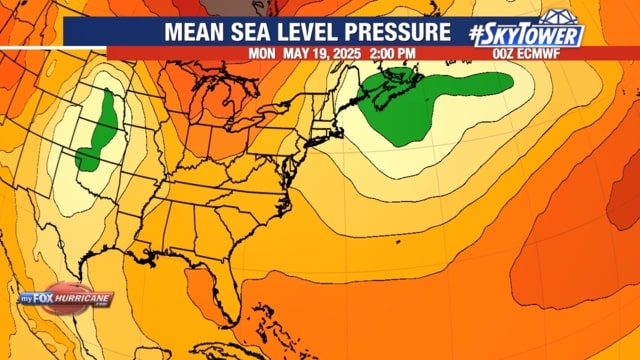
Often dubbed the “gold standard,” ECMWF is one of the most accurate global models, especially 3-10 days out. The image above illustrates a large-scale pressure pattern over North America.
- Region: Global (strongest in mid-latitudes)
- Updates: 2x/day
- Resolution: ~9 km/5.5 miles (HRES), ~18 km/11 miles (ENS)
- Best for: Storm tracking, European weather, tropical cyclone paths
Its ensemble system also gives forecasters a read on forecast confidence.
GFS (Global Forecast System)
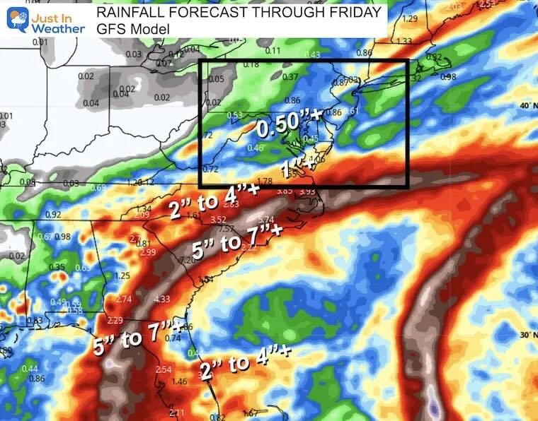
The U.S.’s flagship model has stepped up its game lately, with more frequent updates and improved physics. The image above shows forecast accumulated rainfall (inches) and sea-level pressure for a late-August tropical system.
- Region: Global
- Updates: 4x/day
- Resolution: ~8 miles/13 km (deterministic), ~33 km/20 miles (ensemble)
- Best for: U.S. weather, tropical storms, fast updates
It’s especially handy for short-to-mid range forecasts thanks to its speed and accessibility.
ICON (Icosahedral Nonhydrostatic Model)
Germany’s DWD runs ICON, a model tuned for both global and European precision.
- Region: Global
- Updates: 4x/day
- Resolution: ~13 km (8 miles)
- Best for: Central European weather, mountain systems, wind and convection
ICON blends global and regional forecasts using a shared core, making it a smooth performer.
UKMO (United Kingdom Met Office Global Model)
This UK-based model stands out for maritime and North Atlantic forecasts.
- Region: Global
- Updates: 4x/day
- Resolution: ~6 miles (10 km)
- Best for: UK, Ireland, frontal systems, storm diversity
UKMO excels when blended with other models for ensemble forecasting.
GSM by JMA (Japan Meteorological Agency)
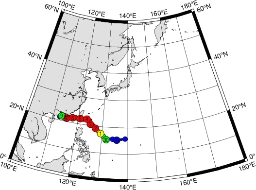
JMA’s GSM model is a steady hand in typhoon season. The image above is showing the path of Typhoon Koinu (2023).
- Region: Global
- Updates: 4x/day
- Resolution: ~20 km (12 miles)
- Best for: Typhoons, East Asia monsoons, marine forecasts
While it doesn’t match ECMWF’s detail, it brings a reliable perspective in storm-prone regions.
Zoom In: Regional Models
Global models give you the big picture, but sometimes you need a microscope, not a telescope. That’s where regional models come in - perfect for zeroing in on terrain-specific or short-range weather events.
COSMO (Consortium for Small-scale Modeling)
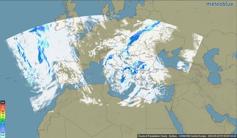
Used across central and eastern Europe, COSMO is all about local precision. The image above displays hourly precipitation (blue shades) and cloud cover.
- Region: Germany, Switzerland, Italy, eastern Europe
- Resolution: 2.2-7 km
- Best for: Thunderstorms, mountain weather, detailed rain forecasts
This model handles complex terrain and convection like a champ and is perfect for tracking high-impact, short-range events.
ICON-EU (ICON Europe Regional Model)
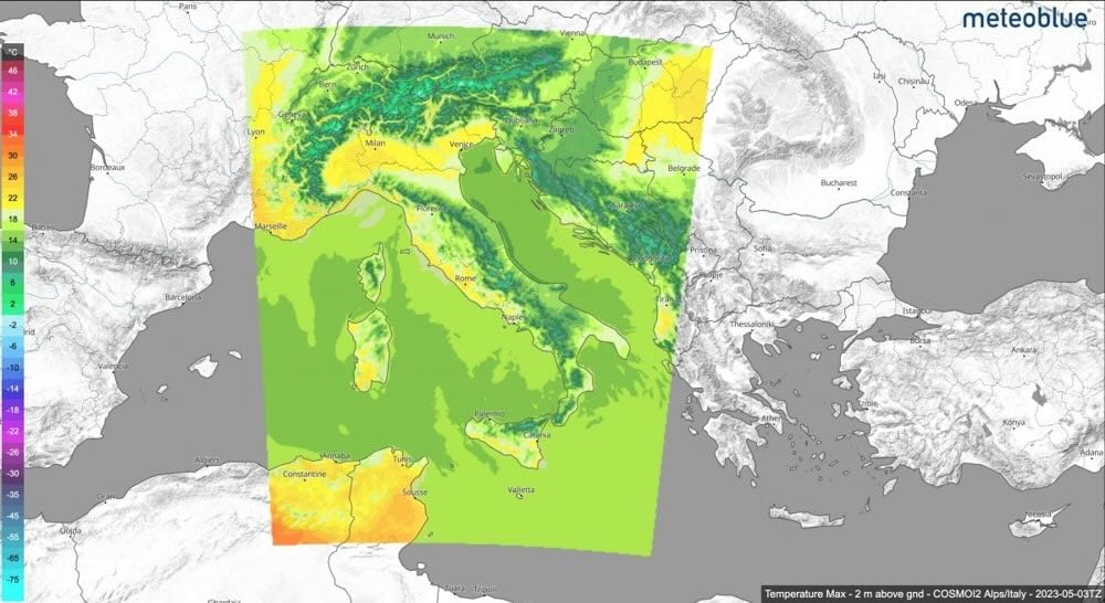
A high-resolution regional variant of ICON, ICON-EU zeroes in on European conditions with a resolution of around 6.5 km. The image above depicts 2-meter maximum temperature over Italy and the Alps.
- Region: Europe
- Resolution: ~6.5 km
- Best for: Alpine snow events, wind systems, urban-scale forecasts
ICON-EU excels at short-term forecasts where topography plays a major role. Whether you’re watching for sudden mountain storms or planning city-level activities, it’s a strong tool for fine-tuned precision.
Choosing the Right Tool
Each model has its sweet spot. Here’s a quick cheat sheet:
| Model | Best For | Region |
|---|---|---|
| ECMWF | Accuracy, storm tracks | Europe, global mid-latitudes |
| GFS | Quick updates, tropical systems | Americas, tropics |
| ICON | Mountain effects, European precision | Central Europe |
| UKMO | Maritime weather, frontal systems | UK, North Atlantic |
| JMA | Typhoons, monsoon cycles | East Asia |
| COSMO | Convection, terrain-driven events | Alps, Central Europe |
| ICON-EU | High-resolution short-range forecasts, alpine effects | Europe |
Model Blending: Why One Isn’t Enough
Forecast pros don’t pick just one model - they compare them. Apps like Rain Viewer use multi-model blends to even out quirks and boost reliability.
Watch for convergence (models agree) or divergence (models disagree). If ECMWF and GFS align on a storm path 5 days out, confidence is high. If they don’t? Expect volatility and check back often.
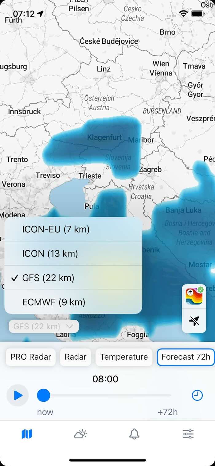
To switch between models in Rain Viewer:
Open the Forecast 72h or Temperature map layer.
In the lower-left corner, choose between and compare ECMWF, GFS, ICON, and ICON-EU (if you’re in Europe) - these are the models we currently support.
Forecasting as a Strategy Game
Every model is a tool, not a crystal ball. Knowing how they differ helps you interpret forecasts more like a pro.
Next time your app surprises you, ask:
- Which model is behind this?
- What’s the ensemble saying?
- Is this trend steady?
Forecasting is a puzzle, and you’ve got the pieces. Dive into Rain Viewer, compare models in real time, and start solving it for yourself.