
When a storm is approaching, timing is everything. Whether you’re planning a quick run, deciding when to leave work, or wondering if it’s safe to stay on the road, you need accurate, up-to-the-minute information. Most people turn to weather forecasts. But here’s the catch: by the time you check the forecast, the weather may have already moved on. Forecasts are predictions. Radar is reality.
In moments when every minute counts, radar gives you what forecasts cannot: a real-time view of what’s happening in the atmosphere right now. That makes it a more powerful, more precise, and more reliable tool for short-term decision-making.
Let’s explore why radar belongs in your weather toolkit and why it often outperforms forecasts when real-time safety and precision matter most.
The Forecast Gap: Useful but Limited
Forecasts are built on complex models that simulate the atmosphere’s behavior. These models pull in a wide range of data - temperature, pressure, wind patterns, humidity, and more - to predict future weather. This process is essential for big-picture planning, like preparing for a weekend trip or a week of outdoor events.
But here’s where the problem lies: forecast models aren’t updated constantly. Many are refreshed only a few times per day. That means the forecast you’re seeing at 3 PM could be based on data from early that morning. For large-scale systems, that might be fine. But for fast-moving, hyperlocal weather events like pop-up thunderstorms, microbursts, or snow squalls? It’s a different story.
Enter Radar: The Nowcasting Champion
Radar doesn’t guess. It scans.
Weather radar sends out pulses of energy. When those pulses hit raindrops, snowflakes, hailstones, or even airborne debris, they bounce back to the radar dish. Radar measures signal strength and timing to reveal where precipitation is, how intense it is, and how it’s moving - all in near real time.
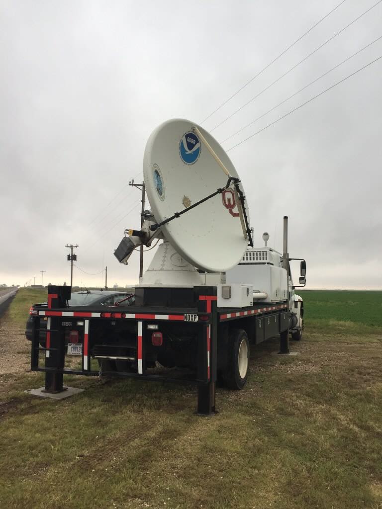
Source: NOAA National Severe Storms Lab / CIMMS (public domain - NOAA imagery)
And it updates quickly. Depending on the system, radar scans are refreshed every 2 to 10 minutes. It means what you see on your radar map is almost what’s happening outside your window.
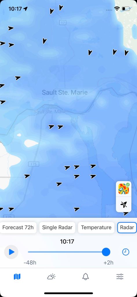
In RainViewer, for example, our radar layers provide a visual snapshot of current precipitation. You can track precipitation as it approaches your location, see where it’s moving, and even anticipate when a break in the storm might come. Here is a detailed snapshot of a snowstorm in Canada in April 2025 with precipitation direction arrows:
Why Radar Wins in Critical Scenarios
Let’s break down a few real-world situations where radar shines:
1. Sudden Thunderstorm Development
Forecast: “Partly cloudy with a chance of isolated storms in the afternoon.”
Radar Reality: It’s 2:37 PM. You’re at a picnic. A strong cell is forming rapidly 12 miles west. Forecasts won’t update for hours but radar already shows the storm building and heading your way. You pack up and leave before the downpour.
2. Severe Weather Tracking
Forecast: “Strong storms possible after 6 PM.”
Radar Reality: It’s 5:48 PM. Rotation appears in a supercell just outside town. Radar detects hook echoes or strong velocity couplets - classic signs of a possible tornado . You take shelter before sirens sound, simply by watching radar patterns in real time.
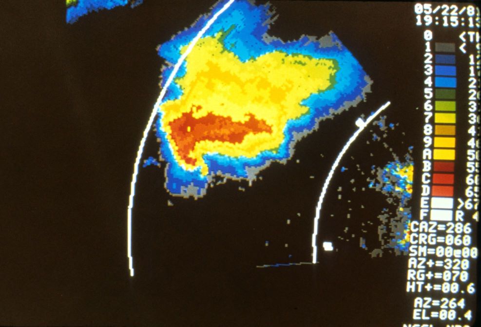
Source: NOAA/NSSL - National Severe Storms Laboratory (CC BY 2.0)
3. Snow Bands and Squalls
Forecast: “Light snow accumulation through the evening.”
Radar Reality: It’s 8:12 PM. A narrow but intense snow band develops and remains stationary over your route home. Radar reveals the exact location and intensity of snowfall. You decide to delay your drive until the squall passes.
4. Outdoor Event Planning
Forecast: “Scattered showers possible in the afternoon.”
Radar Reality: It’s 1:15 PM. You’re monitoring the radar during your child’s soccer game. You notice that a rain cell split and the active portion is missing your location entirely. You stay for the full game, confident in your radar-informed decision.
Radar = Power to Decide
The key difference? Forecasts tell you what might happen. Radar shows you what is happening.
Radar empowers you to:
- See where precipitation is right now
- Gauge the intensity and movement of storms
- Time your activities down to the minute
- Make personal safety decisions with precision
- Spot trends and behavior that models may miss
In high-stakes or time-sensitive scenarios, forecasts are simply too slow. They’re a vital part of long-term planning. But when the skies turn gray and you’re wondering if you have ten minutes or two before the rain hits, only radar can answer that.
Radar Literacy = Forecasting Mastery
At RainViewer, we believe radar interpretation is a skill. And like any skill, it improves with practice.
Over time, you’ll learn to recognize certain patterns:
- The classic bow echo that hints at damaging straight-line winds
- Training storms that suggest flash flooding risks
- Diverging or converging radar signatures that could indicate wind shear or rotation
- Dry slots where precipitation may weaken
- Frontal boundaries and outflow lines where new cells often ignite
That’s why we offer radar animation, map layers, storm tracking tools, and past/future precipitation views. We want to make radar accessible to anyone with the curiosity to learn. Radar isn’t just a graphic - it’s a puzzle, a challenge, a live feed of atmospheric energy in motion.
Ready to level up your radar skills? Explore RainViewer’s radar layers, storm tracking tools, and precipitation alerts today. Let every rain event sharpen your eye and your intuition. Because better forecasting starts with better observing.


